
Viðareiði topographic map
Interactive map
Click on the map to display elevation.
About this map
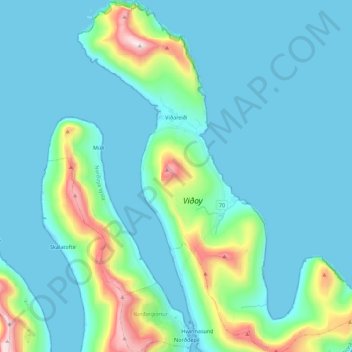
Name: Viðareiði topographic map, elevation, terrain.
Location: Viðareiði, Norðoyar region, 750, Faroe Islands (62.29104 -6.59546 62.39430 -6.41538)
Average elevation: 417 ft
Minimum elevation: -36 ft
Maximum elevation: 2,766 ft
Other topographic maps
Click on a map to view its topography, its elevation and its terrain.
Hvannasund
Faroe Islands > Norðoyar region
Hvannasund, Norðoyar region, 740, Faroe Islands
Average elevation: 784 ft