
Hvannasund topographic map
Interactive map
Click on the map to display elevation.
About this map
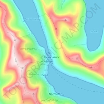
Name: Hvannasund topographic map, elevation, terrain.
Location: Hvannasund, Norðoyar region, 740, Faroe Islands (62.27697 -6.53701 62.32339 -6.40507)
Average elevation: 784 ft
Minimum elevation: -23 ft
Maximum elevation: 2,513 ft
Other topographic maps
Click on a map to view its topography, its elevation and its terrain.
Viðareiði
Faroe Islands > Norðoyar region
Viðareiði, Norðoyar region, 750, Faroe Islands
Average elevation: 417 ft