
Thank you for supporting this site ❤️
Make a donation
Make a donation
Gear up for your next adventure:
As an Amazon Associate, this site earns from qualifying purchases at no extra cost to you.
Litera topographic map
Click on the map to display elevation.
Thank you for supporting this site ❤️
Make a donation
Make a donation
Gear up for your next adventure:
As an Amazon Associate, this site earns from qualifying purchases at no extra cost to you.
About this map
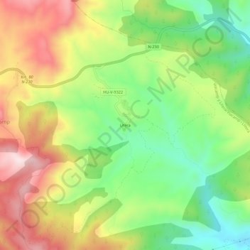
Name: Litera topographic map, elevation, terrain.
Location: Litera, Viacamp y Litera, Ribagorza, Huesca, Aragón, España (42.10727 0.62234 42.14727 0.66234)
Average elevation: 2,500 ft
Minimum elevation: 1,873 ft
Maximum elevation: 3,261 ft
Thank you for supporting this site ❤️
Make a donation
Make a donation
Gear up for your next adventure:
As an Amazon Associate, this site earns from qualifying purchases at no extra cost to you.