Geolocate

Albacina topographic map

Click on the map to display elevation.

About this map

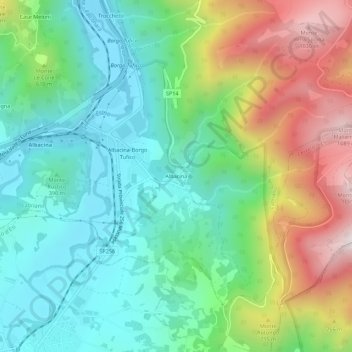
Name: Albacina topographic map, elevation, terrain.

Location: Albacina, Fabriano, Ancona, Marche, 60043, Italia (43.32125 12.98752 43.36125 13.02752)

Average elevation: 1,663 ft

Minimum elevation: 712 ft

Maximum elevation: 3,606 ft

Gear up for your next adventure:

🛰️Satellite Messengers - Emergency SOS and two-way messaging for off-grid adventures
🛶Inflatable Kayak - Portable kayak for rivers, lakes, and expeditions
📚Navigation Handbooks - Master the art of reading topographic maps and using a compass
📖Nature Tracking Books - Learn to track wildlife and terrain
❄️Traction Cleats - Prevent slips on icy trails during winter hikes

As an Amazon Associate, this site earns from qualifying purchases at no extra cost to you.