Geolocate

Beldanga topographic map

Click on the map to display elevation.

Beldanga

Beldanga is located at 23°56′N 88°15′E / 23.93°N 88.25°E / 23.93; 88.25. It has an average elevation of 20 metres (65 feet).

Wikipedia (CC-BY-SA 3.0)

About this map

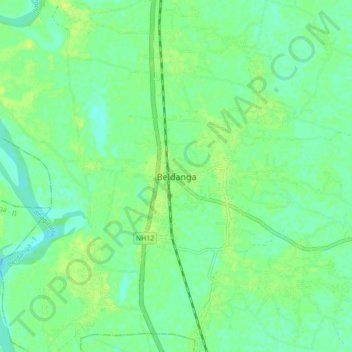
Name: Beldanga topographic map, elevation, terrain.

Location: Beldanga, Beldanga - I, Murshidabad District, West Bengal, 742189, India (23.89780 88.20490 23.97780 88.28490)

Average elevation: 56 ft

Minimum elevation: 33 ft

Maximum elevation: 79 ft

Gear up for your next adventure:

🧭GPS Watch Accessories - Bands and chargers for GPS watches
🧣Merino Neck Gaiters - Multi-functional headwear for wind and sun protection
🔊Portable Camp Speaker - Music and alerts at camp
🗃️Trail First Aid Kit - Essential kit for outdoor injuries and emergencies
🕶️Glacier Sunglasses - Side shields to protect eyes from high-altitude snow glare

As an Amazon Associate, this site earns from qualifying purchases at no extra cost to you.