
Thank you for supporting this site ❤️
Make a donation
Make a donation
Gear up for your next adventure:
As an Amazon Associate, this site earns from qualifying purchases at no extra cost to you.
Librilla topographic map
Click on the map to display elevation.
Thank you for supporting this site ❤️
Make a donation
Make a donation
Gear up for your next adventure:
As an Amazon Associate, this site earns from qualifying purchases at no extra cost to you.
About this map
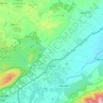
Name: Librilla topographic map, elevation, terrain.
Location: Librilla, Bajo Guadalentín, Region of Murcia, 30892, Spain (37.85980 -1.41066 37.94235 -1.27155)
Average elevation: 804 ft
Minimum elevation: 312 ft
Maximum elevation: 2,963 ft
Thank you for supporting this site ❤️
Make a donation
Make a donation
Gear up for your next adventure:
As an Amazon Associate, this site earns from qualifying purchases at no extra cost to you.