
杨安乡 topographic map
Interactive map
Click on the map to display elevation.
About this map
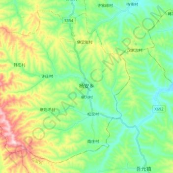
Name: 杨安乡 topographic map, elevation, terrain.
Location: 杨安乡, 沁县, 长治市, 山西省, 中国 (36.42773 112.53218 36.53539 112.68384)
Average elevation: 3,556 ft
Minimum elevation: 3,107 ft
Maximum elevation: 4,534 ft
Other topographic maps
Click on a map to view its topography, its elevation and its terrain.