
郭村镇 topographic map
Interactive map
Click on the map to display elevation.
About this map
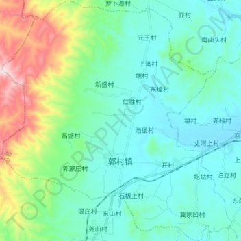
Name: 郭村镇 topographic map, elevation, terrain.
Location: 郭村镇, 沁县, 长治市, 山西省, 中国 (36.71214 112.51511 36.81671 112.64059)
Average elevation: 3,671 ft
Minimum elevation: 3,146 ft
Maximum elevation: 5,656 ft
Other topographic maps
Click on a map to view its topography, its elevation and its terrain.