
Pack River topographic map
Interactive map
Click on the map to display elevation.
About this map
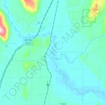
Name: Pack River topographic map, elevation, terrain.
Location: Pack River, Bonner County, Idaho, USA (48.36266 -116.54086 48.45157 -116.40723)
Average elevation: 2,221 ft
Minimum elevation: 2,067 ft
Maximum elevation: 3,517 ft
Other topographic maps
Click on a map to view its topography, its elevation and its terrain.
Pend Oreille River
Pend Oreille River, Bonner County, Idaho, 83822, USA
Average elevation: 2,178 ft
Garden City
USA > Idaho > Garden City
Garden City, Ada County, Idaho, 83614, USA
Average elevation: 2,795 ft