Geolocate

Ananuri topographic map

Interactive map

Click on the map to display elevation.

About this map

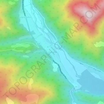
Name: Ananuri topographic map, elevation, terrain.

Location: Ananuri, Dusheti Municipality, Mtskheta-Mtianeti, Georgia (42.15703 44.67060 42.19703 44.71060)

Average elevation: 3,461 ft

Minimum elevation: 2,585 ft

Maximum elevation: 5,194 ft

Other topographic maps

Click on a map to view its topography, its elevation and its terrain.

Tsikhisdziri

Georgia > Mtskheta-Mtianeti > Dusheti Municipality

Tsikhisdziri, Dusheti Municipality, Mtskheta-Mtianeti, Georgia

Average elevation: 3,497 ft

Caucasus Mountains

Georgia > Mtskheta-Mtianeti > Dusheti Municipality > Chalisopeli

Caucasus Mountains, Chalisopeli, Dusheti Municipality, Mtskheta-Mtianeti, Georgia

Average elevation: 7,178 ft