
Thank you for supporting this site ❤️
Make a donation
Make a donation
Gear up for your next adventure:
As an Amazon Associate, this site earns from qualifying purchases at no extra cost to you.
Qeqertarsuaq topographic map
Click on the map to display elevation.
Thank you for supporting this site ❤️
Make a donation
Make a donation
Gear up for your next adventure:
As an Amazon Associate, this site earns from qualifying purchases at no extra cost to you.
About this map
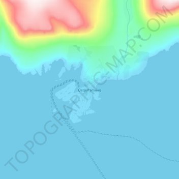
Name: Qeqertarsuaq topographic map, elevation, terrain.
Location: Qeqertarsuaq, Qeqertalik, 3953, Greenland (69.20624 -53.57537 69.28624 -53.49537)
Average elevation: 312 ft
Minimum elevation: -7 ft
Maximum elevation: 2,392 ft
Thank you for supporting this site ❤️
Make a donation
Make a donation
Gear up for your next adventure:
As an Amazon Associate, this site earns from qualifying purchases at no extra cost to you.