
Thank you for supporting this site ❤️
Make a donation
Make a donation
Gear up for your next adventure:
As an Amazon Associate, this site earns from qualifying purchases at no extra cost to you.
Grosbous topographic map
Click on the map to display elevation.
Thank you for supporting this site ❤️
Make a donation
Make a donation
Gear up for your next adventure:
As an Amazon Associate, this site earns from qualifying purchases at no extra cost to you.
About this map
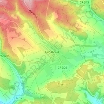
Name: Grosbous topographic map, elevation, terrain.
Location: Grosbous, Groussbus-Wal, Canton Redange, 9154, Luxembourg (49.80756 5.94440 49.84756 5.98440)
Average elevation: 1,211 ft
Minimum elevation: 945 ft
Maximum elevation: 1,532 ft
Thank you for supporting this site ❤️
Make a donation
Make a donation
Gear up for your next adventure:
As an Amazon Associate, this site earns from qualifying purchases at no extra cost to you.