
Hobart topographic map
Click on the map to display elevation.
About this map
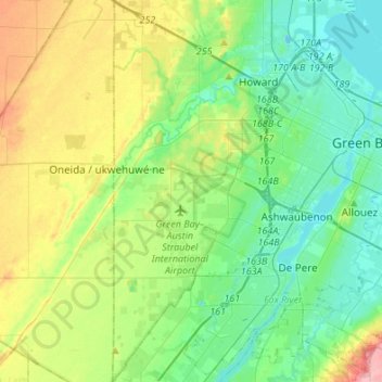
Name: Hobart topographic map, elevation, terrain.
Location: Hobart, Brown County, Wisconsin, 54155, United States (44.39157 -88.19143 44.58447 -88.09721)
Average elevation: 682 ft
Minimum elevation: 571 ft
Maximum elevation: 938 ft
Brown County trails, hiking, mountain biking, running and outdoor activities
Other topographic maps
Click on a map to view its topography, its elevation and its terrain.