
Thank you for supporting this site ❤️
Make a donation
Make a donation
Gear up for your next adventure:
As an Amazon Associate, this site earns from qualifying purchases at no extra cost to you.
tasnal topographic map
Click on the map to display elevation.
Thank you for supporting this site ❤️
Make a donation
Make a donation
Gear up for your next adventure:
As an Amazon Associate, this site earns from qualifying purchases at no extra cost to you.
About this map
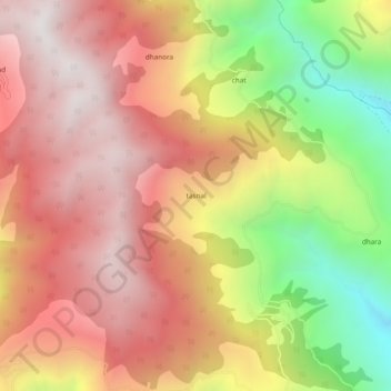
Name: tasnal topographic map, elevation, terrain.
Location: tasnal, Doda, Doda District, Jammu and Kashmir, 182201, India (33.16084 75.61231 33.20084 75.65231)
Average elevation: 6,804 ft
Minimum elevation: 4,190 ft
Maximum elevation: 8,622 ft
Thank you for supporting this site ❤️
Make a donation
Make a donation
Gear up for your next adventure:
As an Amazon Associate, this site earns from qualifying purchases at no extra cost to you.