
泗河 topographic map
Interactive map
Click on the map to display elevation.
About this map
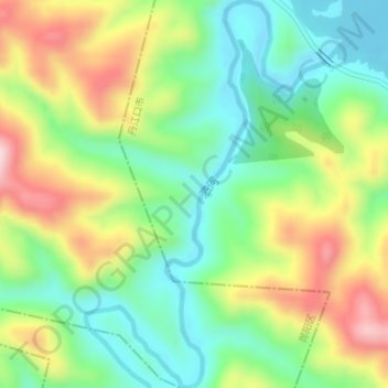
Name: 泗河 topographic map, elevation, terrain.
Location: 泗河, 丹江口市, 十堰市, 湖北省, 中国 (32.65172 110.91179 32.68038 110.92517)
Average elevation: 896 ft
Minimum elevation: 489 ft
Maximum elevation: 1,532 ft
Other topographic maps
Click on a map to view its topography, its elevation and its terrain.