Geolocate

Chuyabamba topographic map

Click on the map to display elevation.

About this map

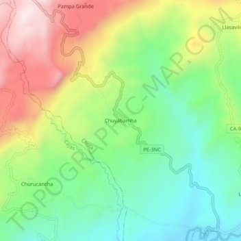
Name: Chuyabamba topographic map, elevation, terrain.

Location: Chuyabamba, Chota, Cajamarca, Perú (-6.53845 -78.72896 -6.49845 -78.68896)

Average elevation: 8,038 ft

Minimum elevation: 7,234 ft

Maximum elevation: 9,245 ft

Gear up for your next adventure:

🛰️Satellite Messengers - Emergency SOS and two-way messaging for off-grid adventures
🎒Gear Packing Cubes - Organize your backpack efficiently
🧣Hiking Neck Gaiter - Multi‑use neck protection for outdoor weather
🪵Folding Camp Saw - Compact saw for wood and campsite work
📡GPS Antenna Upgrade - Enhance GPS reception in remote terrain

As an Amazon Associate, this site earns from qualifying purchases at no extra cost to you.