
Make a donation
Gear up for your next adventure:
As an Amazon Associate, this site earns from qualifying purchases at no extra cost to you.
Highlandville topographic map
Click on the map to display elevation.
Make a donation
Gear up for your next adventure:
As an Amazon Associate, this site earns from qualifying purchases at no extra cost to you.
Highlandville
A post office called Highlandville has been in operation since 1872. The city was named on account of its lofty elevation.
Make a donation
Gear up for your next adventure:
As an Amazon Associate, this site earns from qualifying purchases at no extra cost to you.
About this map
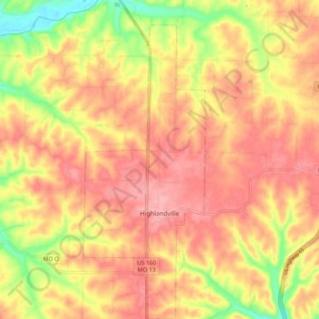
Name: Highlandville topographic map, elevation, terrain.
Location: Highlandville, Christian County, Missouri, United States (36.90775 -93.30350 36.98317 -93.26687)
Average elevation: 1,263 ft
Minimum elevation: 1,047 ft
Maximum elevation: 1,385 ft
Christian County trails, hiking, mountain biking, running and outdoor activities
Make a donation
Gear up for your next adventure:
As an Amazon Associate, this site earns from qualifying purchases at no extra cost to you.
Other topographic maps
Click on a map to view its topography, its elevation and its terrain.