
Stacy topographic map
Click on the map to display elevation.
About this map
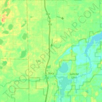
Name: Stacy topographic map, elevation, terrain.
Location: Stacy, Chisago County, Minnesota, United States (45.36908 -93.02168 45.47050 -92.89695)
Average elevation: 899 ft
Minimum elevation: 856 ft
Maximum elevation: 968 ft
Chisago County trails, hiking, mountain biking, running and outdoor activities
Other topographic maps
Click on a map to view its topography, its elevation and its terrain.
Chain Lake
United States > Minnesota > Chisago County > North Branch > Harris
Average elevation: 922 ft