Geolocate

Crest topographic map

Click on the map to display elevation.

About this map

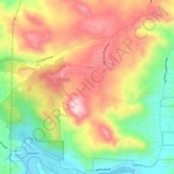
Name: Crest topographic map, elevation, terrain.

Location: Crest, San Diego County, California, United States (32.77906 -116.89370 32.82496 -116.84090)

Average elevation: 1,152 ft

Minimum elevation: 430 ft

Maximum elevation: 1,886 ft

San Diego County trails, hiking, mountain biking, running and outdoor activities

Gear up for your next adventure:

🧭Orienteering Set - Complete compass and map reading kit
🛰️Satellite Messengers - Emergency SOS and two-way messaging for off-grid adventures
🥘Titanium Cookware - Durable, featherlight pots and pans for backpacking
🗺️Topographic Maps - Detailed topo maps for hiking, exploring and outdoor navigation
🎁Geography Themed Gifts - Unique gift ideas for map lovers and geography enthusiasts

As an Amazon Associate, this site earns from qualifying purchases at no extra cost to you.