
Nebeur topographic map
Interactive map
Click on the map to display elevation.
About this map
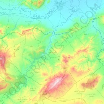
Name: Nebeur topographic map, elevation, terrain.
Location: Nebeur, Le Kef, Tunisie (36.20684 8.51670 36.45343 8.98734)
Average elevation: 1,273 ft
Minimum elevation: 440 ft
Maximum elevation: 3,514 ft
Other topographic maps
Click on a map to view its topography, its elevation and its terrain.