
Dahmani topographic map
Interactive map
Click on the map to display elevation.
About this map
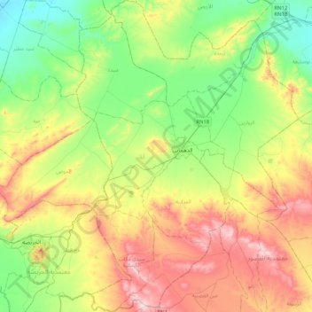
Name: Dahmani topographic map, elevation, terrain.
Location: Dahmani, Le Kef, 7170, Tunisie (35.77037 8.68908 36.10034 8.97996)
Average elevation: 2,316 ft
Minimum elevation: 1,542 ft
Maximum elevation: 3,602 ft
Other topographic maps
Click on a map to view its topography, its elevation and its terrain.