Geolocate

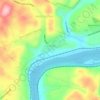
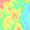
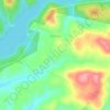
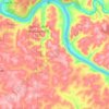
Adrian topographic map

Click on the map to display elevation.

About this map

Name: Adrian topographic map, elevation, terrain.

Location: Adrian, East Franklin Township, Armstrong County, Pennsylvania, 16210, United States (40.86479 -79.55782 40.90479 -79.51782)

Average elevation: 1,204 ft

Minimum elevation: 899 ft

Maximum elevation: 1,444 ft

Armstrong County trails, hiking, mountain biking, running and outdoor activities

Other topographic maps

Click on a map to view its topography, its elevation and its terrain.
West Hills

United States > Pennsylvania > Armstrong County

Average elevation: 1,079 ft

Orchard Hills

United States > Pennsylvania > Armstrong County

Average elevation: 1,138 ft

Elderton

United States > Pennsylvania > Armstrong County

Average elevation: 1,155 ft

Rural Valley

United States > Pennsylvania > Armstrong County

Average elevation: 1,217 ft

Atwood

United States > Pennsylvania > Armstrong County

Average elevation: 1,227 ft

Applewold

United States > Pennsylvania > Armstrong County

Average elevation: 988 ft

Plum Creek

United States > Pennsylvania > Armstrong County

Average elevation: 1,165 ft

Gear up for your next adventure:

🌧️Backpack Rain Cover - Keep gear dry in wet weather
🛏️Cold Weather Sleeping Bag - Warm sleeping bag for cold conditions
🦺Reflective Outdoor Gear - Safety gear for low‑light conditions
🚁Photography Drones - Capture stunning aerial views of landforms and topography
🌡️Handheld Weather Meters - Measure wind, temp, and pressure for safe mountain travel

As an Amazon Associate, this site earns from qualifying purchases at no extra cost to you.