Geolocate

Smoke Rise topographic map

Click on the map to display elevation.

About this map

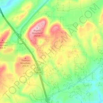
Name: Smoke Rise topographic map, elevation, terrain.

Location: Smoke Rise, Hayden, Blount County, Alabama, United States (33.84516 -86.84940 33.91052 -86.80359)

Average elevation: 669 ft

Minimum elevation: 322 ft

Maximum elevation: 1,148 ft

Blount County trails, hiking, mountain biking, running and outdoor activities

Gear up for your next adventure:

🧢Outdoor Hiking Hat - Sun protection hat for outdoor explorers
🪶Compact Camp Shovel - Folding shovel for campsite tasks
🔥Plasma Lighters - Windproof lighters that work in any weather condition
🧭Orienteering Set - Complete compass and map reading kit
🎒Day Hiking Backpack - Lightweight backpack perfect for day trips and outdoor adventures

As an Amazon Associate, this site earns from qualifying purchases at no extra cost to you.