
Thank you for supporting this site ❤️
Make a donation
Make a donation
Gear up for your next adventure:
As an Amazon Associate, this site earns from qualifying purchases at no extra cost to you.
Chiconcuac topographic map
Click on the map to display elevation.
Thank you for supporting this site ❤️
Make a donation
Make a donation
Gear up for your next adventure:
As an Amazon Associate, this site earns from qualifying purchases at no extra cost to you.
About this map
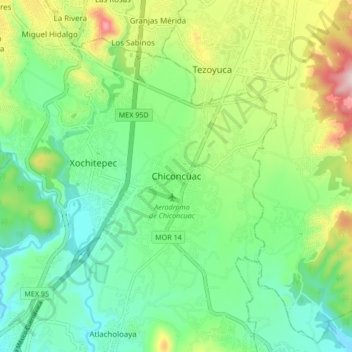
Name: Chiconcuac topographic map, elevation, terrain.
Location: Chiconcuac, Xochitepec, Morelos, 62790, México (18.74015 -99.25083 18.82015 -99.17083)
Average elevation: 3,773 ft
Minimum elevation: 3,376 ft
Maximum elevation: 4,629 ft
Thank you for supporting this site ❤️
Make a donation
Make a donation
Gear up for your next adventure:
As an Amazon Associate, this site earns from qualifying purchases at no extra cost to you.