Geolocate

Everton topographic map

Click on the map to display elevation.

About this map

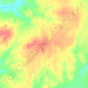
Name: Everton topographic map, elevation, terrain.

Location: Everton, Fayette County, Indiana, United States (39.54283 -85.10968 39.58283 -85.06968)

Average elevation: 997 ft

Minimum elevation: 863 ft

Maximum elevation: 1,086 ft

Fayette County trails, hiking, mountain biking, running and outdoor activities

Gear up for your next adventure:

🪓Survival Multi‑Tool - Versatile tool for camp and trail tasks
🌡️Handheld Weather Meters - Measure wind, temp, and pressure for safe mountain travel
🪶Thermal Camp Blanket - Extra warmth for cold nights
👟Men's Trail Runners - Lightweight footwear for fast-paced exploration and light hiking
📶Vehicle Signal Boosters - Improve reception in rural areas while driving to trailheads

As an Amazon Associate, this site earns from qualifying purchases at no extra cost to you.