Geolocate

Willis topographic map

Click on the map to display elevation.

About this map

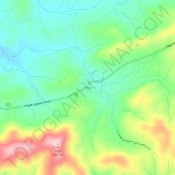
Name: Willis topographic map, elevation, terrain.

Location: Willis, Floyd County, Virginia, 24380, United States (36.83791 -80.50089 36.87791 -80.46089)

Average elevation: 2,861 ft

Minimum elevation: 2,579 ft

Maximum elevation: 3,379 ft

Floyd County trails, hiking, mountain biking, running and outdoor activities

Gear up for your next adventure:

🥘Titanium Cookware - Durable, featherlight pots and pans for backpacking
🌄Hiking Binoculars - Compact binoculars for scenic views and trail spotting
🎒Outdoor Daypacks - Lightweight backpacks designed for carrying maps and essential gear
Solar GPS Watches - Advanced multisport watches with built-in topographic maps
🏫Relief Map Kits - Hands-on tools for teaching landforms and elevation

As an Amazon Associate, this site earns from qualifying purchases at no extra cost to you.