
Thank you for supporting this site ❤️
Make a donation
Make a donation
Gear up for your next adventure:
As an Amazon Associate, this site earns from qualifying purchases at no extra cost to you.
Pyalong topographic map
Click on the map to display elevation.
Thank you for supporting this site ❤️
Make a donation
Make a donation
Gear up for your next adventure:
As an Amazon Associate, this site earns from qualifying purchases at no extra cost to you.
About this map
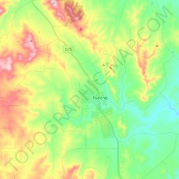
Name: Pyalong topographic map, elevation, terrain.
Location: Pyalong, Shire of Mitchell, Victoria, 3521, Australia (-37.17504 144.76855 -37.04720 144.92365)
Average elevation: 1,096 ft
Minimum elevation: 669 ft
Maximum elevation: 1,818 ft
Thank you for supporting this site ❤️
Make a donation
Make a donation
Gear up for your next adventure:
As an Amazon Associate, this site earns from qualifying purchases at no extra cost to you.