
Thank you for supporting this site ❤️
Make a donation
Make a donation
Gear up for your next adventure:
As an Amazon Associate, this site earns from qualifying purchases at no extra cost to you.
Bolnes topographic map
Click on the map to display elevation.
Thank you for supporting this site ❤️
Make a donation
Make a donation
Gear up for your next adventure:
As an Amazon Associate, this site earns from qualifying purchases at no extra cost to you.
About this map
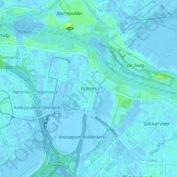
Name: Bolnes topographic map, elevation, terrain.
Location: Bolnes, Ridderkerk, Zuid-Holland, Nederland, 2987 CW, Nederland (51.87166 4.56192 51.91166 4.60192)
Average elevation: 3 ft
Minimum elevation: -13 ft
Maximum elevation: 43 ft
Thank you for supporting this site ❤️
Make a donation
Make a donation
Gear up for your next adventure:
As an Amazon Associate, this site earns from qualifying purchases at no extra cost to you.