Geolocate

Trezzo sull'Adda topographic map

Click on the map to display elevation.

About this map

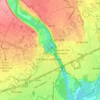
Name: Trezzo sull'Adda topographic map, elevation, terrain.

Location: Trezzo sull'Adda, Milan, Lombardy, 20056, Italy (45.58756 9.47590 45.63915 9.53319)

Average elevation: 617 ft

Minimum elevation: 433 ft

Maximum elevation: 768 ft

Other topographic maps

Click on a map to view its topography, its elevation and its terrain.

Milan

Italy > Lombardy > Milan > Milan

Average elevation: 427 ft

Tregarezzo

Italy > Lombardy > Milan > Segrate > San Felice

Average elevation: 377 ft

Cascina Confaloniera

Italy > Lombardy > Milan > Rosate

Average elevation: 351 ft

Vaiano Valle

Italy > Lombardy > Milan > Milan

Average elevation: 361 ft

Gear up for your next adventure:

🔦Compact Flashlight - Reliable flashlight for emergencies
🪶Compact Camp Shovel - Folding shovel for campsite tasks
🔥Plasma Lighters - Windproof lighters that work in any weather condition
🌎3D Topographic Globes - Raised relief globes for a tactile understanding of geography
🎒Outdoor Daypacks - Lightweight backpacks designed for carrying maps and essential gear

As an Amazon Associate, this site earns from qualifying purchases at no extra cost to you.