Geolocate

Gaitan topographic map

Click on the map to display elevation.

About this map

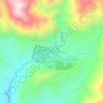
Name: Gaitan topographic map, elevation, terrain.

Location: Gaitan, Sur, Tolima, Colombia (3.51243 -75.66472 3.55243 -75.62472)

Average elevation: 3,930 ft

Minimum elevation: 2,884 ft

Maximum elevation: 5,869 ft

Gear up for your next adventure:

📷Action Camera - Capture your outdoor adventures in HD
🔭Stargazing Telescopes - Perfect for camping in low-light pollution areas shown on maps
🪶Thermal Camp Blanket - Extra warmth for cold nights
👖Convertible Hiking Pants - Versatile zip-off pants for changing altitudes and temperatures
🧢Sun Protection Hats - Wide-brimmed and UPF-rated hats for high-altitude sun safety

As an Amazon Associate, this site earns from qualifying purchases at no extra cost to you.