
Thank you for supporting this site ❤️
Make a donation
Make a donation
Gear up for your next adventure:
As an Amazon Associate, this site earns from qualifying purchases at no extra cost to you.
Rubiales topographic map
Click on the map to display elevation.
Thank you for supporting this site ❤️
Make a donation
Make a donation
Gear up for your next adventure:
As an Amazon Associate, this site earns from qualifying purchases at no extra cost to you.
About this map
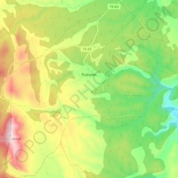
Name: Rubiales topographic map, elevation, terrain.
Location: Rubiales, Sierra de Albarracín, Teruel, Aragon, Spain (40.23655 -1.31437 40.30501 -1.23258)
Average elevation: 3,940 ft
Minimum elevation: 3,248 ft
Maximum elevation: 4,849 ft
Thank you for supporting this site ❤️
Make a donation
Make a donation
Gear up for your next adventure:
As an Amazon Associate, this site earns from qualifying purchases at no extra cost to you.