
Thank you for supporting this site ❤️
Make a donation
Make a donation
Gear up for your next adventure:
As an Amazon Associate, this site earns from qualifying purchases at no extra cost to you.
Rupasccahuasi topographic map
Click on the map to display elevation.
Thank you for supporting this site ❤️
Make a donation
Make a donation
Gear up for your next adventure:
As an Amazon Associate, this site earns from qualifying purchases at no extra cost to you.
About this map
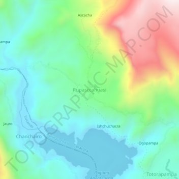
Name: Rupasccahuasi topographic map, elevation, terrain.
Location: Rupasccahuasi, Coracora, Parinacochas, Ayacucho, Perú (-14.92604 -73.86284 -14.88604 -73.82284)
Average elevation: 11,893 ft
Minimum elevation: 11,181 ft
Maximum elevation: 13,589 ft
Thank you for supporting this site ❤️
Make a donation
Make a donation
Gear up for your next adventure:
As an Amazon Associate, this site earns from qualifying purchases at no extra cost to you.