Geolocate

Radcliffe topographic map

Click on the map to display elevation.

About this map

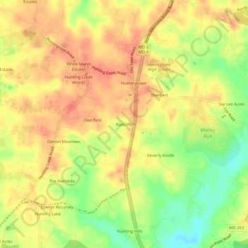
Name: Radcliffe topographic map, elevation, terrain.

Location: Radcliffe, Calvert County, Maryland, 20639, United States (38.58929 -76.63496 38.62929 -76.59496)

Average elevation: 115 ft

Minimum elevation: 3 ft

Maximum elevation: 180 ft

Calvert County trails, hiking, mountain biking, running and outdoor activities

Gear up for your next adventure:

🎒Gear Packing Cubes - Organize your backpack efficiently
🪵Folding Camp Saw - Compact saw for wood and campsite work
📡GPS Antenna Upgrade - Enhance GPS reception in remote terrain
🧭Hiking Compass - Precision compass for reliable navigation in the wilderness
🚁Photography Drones - Capture stunning aerial views of landforms and topography

As an Amazon Associate, this site earns from qualifying purchases at no extra cost to you.