
Nestor Falls topographic map
Interactive map
Click on the map to display elevation.
About this map
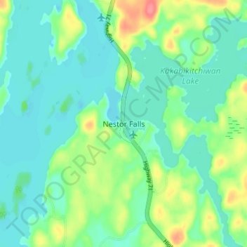
Name: Nestor Falls topographic map, elevation, terrain.
Average elevation: 1,106 ft
Minimum elevation: 1,043 ft
Maximum elevation: 1,270 ft
Other topographic maps
Click on a map to view its topography, its elevation and its terrain.
Sioux Narrows
Canada > Ontario > Kenora District > Sioux Narrows-Nestor Falls Township
Sioux Narrows, Sioux Narrows-Nestor Falls Township, Kenora District, Northwestern Ontario, Ontario, P0X 1N0, Canada
Average elevation: 1,079 ft
Forbes Lake
Canada > Ontario > Kenora District > Sioux Narrows-Nestor Falls Township
Forbes Lake, Sioux Narrows-Nestor Falls Township, Kenora District, Northwestern Ontario, Ontario, Canada
Average elevation: 1,224 ft