
Thank you for supporting this site ❤️
Make a donation
Make a donation
Gear up for your next adventure:
As an Amazon Associate, this site earns from qualifying purchases at no extra cost to you.
Casas topographic map
Click on the map to display elevation.
Thank you for supporting this site ❤️
Make a donation
Make a donation
Gear up for your next adventure:
As an Amazon Associate, this site earns from qualifying purchases at no extra cost to you.
About this map
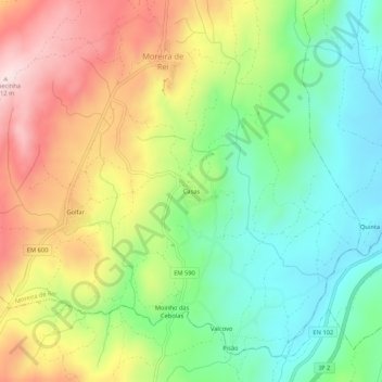
Name: Casas topographic map, elevation, terrain.
Location: Casas, Moreira de Rei, Trancoso, Guarda, 6420-153, Portugal (40.79685 -7.33762 40.83685 -7.29762)
Average elevation: 2,274 ft
Minimum elevation: 1,762 ft
Maximum elevation: 2,982 ft
Thank you for supporting this site ❤️
Make a donation
Make a donation
Gear up for your next adventure:
As an Amazon Associate, this site earns from qualifying purchases at no extra cost to you.