Geolocate

Fremont topographic map

Click on the map to display elevation.

About this map

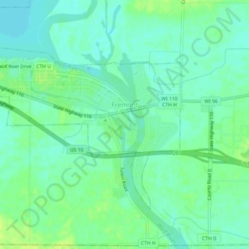
Name: Fremont topographic map, elevation, terrain.

Location: Fremont, Waupaca County, Wisconsin, United States (44.24692 -88.89761 44.26756 -88.85517)

Average elevation: 761 ft

Minimum elevation: 738 ft

Maximum elevation: 794 ft

Waupaca County trails, hiking, mountain biking, running and outdoor activities

Other topographic maps

Click on a map to view its topography, its elevation and its terrain.

King

United States > Wisconsin > Waupaca County

Average elevation: 912 ft

Readfield

United States > Wisconsin > Waupaca County

Average elevation: 827 ft

Holman Lake

United States > Wisconsin > Waupaca County

Average elevation: 925 ft

Gear up for your next adventure:

🗺️NatGeo Topo Maps - High-quality waterproof printed topographic maps of US Parks
🪶Camp Gear Gift Set - Perfect gift bundle for outdoor fans
💧Water Filtration Bottles - Safely drink from streams and lakes while exploring
🔥Fast-Boil Camping Stoves - Efficient cooking systems for quick trail meals
Backpacking Tent - Lightweight and durable tent for multi‑day hikes

As an Amazon Associate, this site earns from qualifying purchases at no extra cost to you.