
Make a donation
Gear up for your next adventure:
As an Amazon Associate, this site earns from qualifying purchases at no extra cost to you.
Spooner topographic map
Click on the map to display elevation.
Make a donation
Gear up for your next adventure:
As an Amazon Associate, this site earns from qualifying purchases at no extra cost to you.
About this map
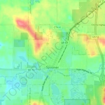
Name: Spooner topographic map, elevation, terrain.
Location: Spooner, Washburn County, Wisconsin, United States (45.80909 -91.92397 45.85082 -91.85128)
Average elevation: 1,102 ft
Minimum elevation: 1,027 ft
Maximum elevation: 1,243 ft
Washburn County trails, hiking, mountain biking, running and outdoor activities
Make a donation
Gear up for your next adventure:
As an Amazon Associate, this site earns from qualifying purchases at no extra cost to you.
Other topographic maps
Click on a map to view its topography, its elevation and its terrain.
Beartrap Lake
United States > Wisconsin > Washburn County > Town of Birchwood
Average elevation: 1,414 ft