Geolocate

Thompson Plateau topographic map

Click on the map to display elevation.

About this map

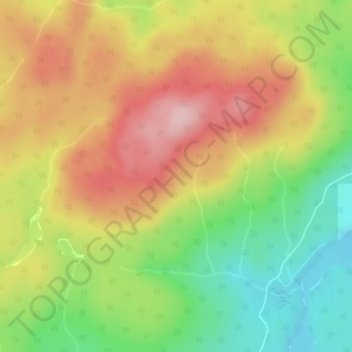
Name: Thompson Plateau topographic map, elevation, terrain.

Location: Thompson Plateau, East Central Okanagan Electoral Area, Regional District of Central Okanagan, British Columbia, Canada (50.10412 -119.19390 50.12412 -119.17390)

Average elevation: 4,760 ft

Minimum elevation: 4,416 ft

Maximum elevation: 5,095 ft

Other topographic maps

Click on a map to view its topography, its elevation and its terrain.

Gear up for your next adventure:

📚Navigation Handbooks - Master the art of reading topographic maps and using a compass
🗺️Topographic Maps - Detailed topo maps for hiking, exploring and outdoor navigation
🗻Climbing Gear Basics - Essential gear for beginner climbers
🦺Reflective Outdoor Gear - Safety gear for low‑light conditions
🥾Men's Hiking Boots - Durable, waterproof footwear for rugged terrain and steep inclines

As an Amazon Associate, this site earns from qualifying purchases at no extra cost to you.