
Merouana topographic map
Click on the map to display elevation.
About this map
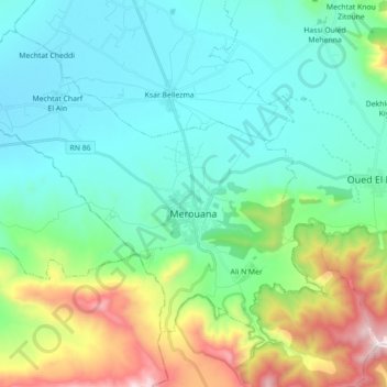
Name: Merouana topographic map, elevation, terrain.
Location: Merouana, Merouana district, Batna, 05300, Algeria (35.57891 5.79733 35.70028 5.97394)
Average elevation: 3,743 ft
Minimum elevation: 2,874 ft
Maximum elevation: 6,585 ft