Geolocate

Sector 65 topographic map

Click on the map to display elevation.

About this map

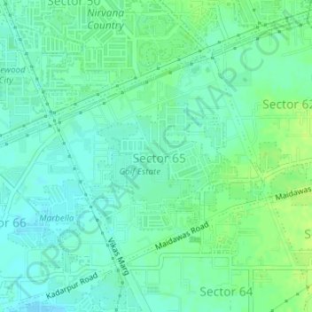
Name: Sector 65 topographic map, elevation, terrain.

Location: Sector 65, Gurgaon, Gurugram, Haryana, India (28.39400 77.05898 28.41228 77.08058)

Average elevation: 758 ft

Minimum elevation: 738 ft

Maximum elevation: 781 ft

Other topographic maps

Click on a map to view its topography, its elevation and its terrain.

Badshahpur

India > Haryana > Gurgaon

Average elevation: 748 ft

Damdama Lake

India > Haryana > Gurgaon

Average elevation: 794 ft

Gear up for your next adventure:

🧣Merino Neck Gaiters - Multi-functional headwear for wind and sun protection
🔭Compact Binoculars - HD vision for scouting terrain and identifying distant landmarks
🪶Wildlife Field Guides - Learn animal tracking and species ID
🧤Tactile Hiking Gloves - Keep hands warm while operating GPS and smartphone screens
🛌Ultralight Sleeping Bags - Compact down bags for cold nights in the wilderness

As an Amazon Associate, this site earns from qualifying purchases at no extra cost to you.