
Clinton topographic map
Click on the map to display elevation.
About this map
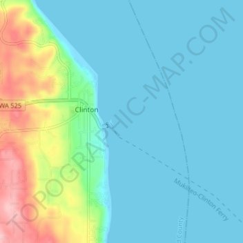
Name: Clinton topographic map, elevation, terrain.
Location: Clinton, Island County, Washington, United States (47.95394 -122.36863 47.99752 -122.32846)
Average elevation: 108 ft
Minimum elevation: -3 ft
Maximum elevation: 541 ft
Island County trails, hiking, mountain biking, running and outdoor activities