
Thank you for supporting this site ❤️
Make a donation
Make a donation
Gear up for your next adventure:
As an Amazon Associate, this site earns from qualifying purchases at no extra cost to you.
Chengguan topographic map
Click on the map to display elevation.
Thank you for supporting this site ❤️
Make a donation
Make a donation
Gear up for your next adventure:
As an Amazon Associate, this site earns from qualifying purchases at no extra cost to you.
About this map
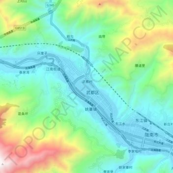
Name: Chengguan topographic map, elevation, terrain.
Location: Chengguan, Wudu District, Longnan City, Gansu, 746000, China (33.35417 104.88122 33.43417 104.96122)
Average elevation: 4,869 ft
Minimum elevation: 3,241 ft
Maximum elevation: 9,508 ft
Thank you for supporting this site ❤️
Make a donation
Make a donation
Gear up for your next adventure:
As an Amazon Associate, this site earns from qualifying purchases at no extra cost to you.