
Thank you for supporting this site ❤️
Make a donation
Make a donation
Gear up for your next adventure:
As an Amazon Associate, this site earns from qualifying purchases at no extra cost to you.
Gandikota topographic map
Click on the map to display elevation.
Thank you for supporting this site ❤️
Make a donation
Make a donation
Gear up for your next adventure:
As an Amazon Associate, this site earns from qualifying purchases at no extra cost to you.
About this map
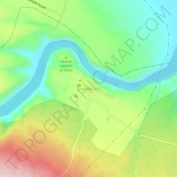
Name: Gandikota topographic map, elevation, terrain.
Location: Gandikota, Jammalamadugu, YSR Kadapa, Andhra Pradesh, India (14.79499 78.26700 14.83499 78.30700)
Average elevation: 974 ft
Minimum elevation: 597 ft
Maximum elevation: 1,578 ft
Thank you for supporting this site ❤️
Make a donation
Make a donation
Gear up for your next adventure:
As an Amazon Associate, this site earns from qualifying purchases at no extra cost to you.