
Thank you for supporting this site ❤️
Make a donation
Make a donation
Gear up for your next adventure:
As an Amazon Associate, this site earns from qualifying purchases at no extra cost to you.
Campolongo topographic map
Click on the map to display elevation.
Thank you for supporting this site ❤️
Make a donation
Make a donation
Gear up for your next adventure:
As an Amazon Associate, this site earns from qualifying purchases at no extra cost to you.
About this map
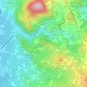
Name: Campolongo topographic map, elevation, terrain.
Location: Campolongo, Vo', Padova, Veneto, 35030, Italia (45.33701 11.66133 45.33711 11.66143)
Average elevation: 397 ft
Minimum elevation: 62 ft
Maximum elevation: 1,158 ft
Thank you for supporting this site ❤️
Make a donation
Make a donation
Gear up for your next adventure:
As an Amazon Associate, this site earns from qualifying purchases at no extra cost to you.