Geolocate

Matamoras topographic map

Click on the map to display elevation.

About this map

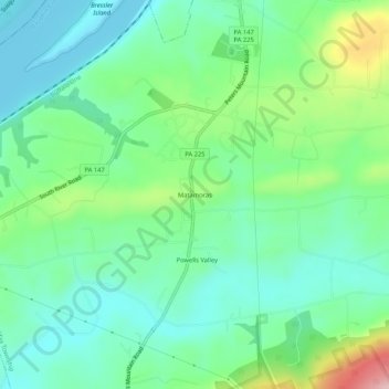
Name: Matamoras topographic map, elevation, terrain.

Location: Matamoras, Halifax Township, Dauphin County, Pennsylvania, 17069, United States (40.41880 -76.95324 40.45880 -76.91324)

Average elevation: 558 ft

Minimum elevation: 348 ft

Maximum elevation: 1,214 ft

Dauphin County trails, hiking, mountain biking, running and outdoor activities

Other topographic maps

Click on a map to view its topography, its elevation and its terrain.

Gear up for your next adventure:

🧭Orienteering Set - Complete compass and map reading kit
🥾Women's Hiking Boots - Top-rated trail boots with ankle support and superior grip
🌄Hiking Binoculars - Compact binoculars for scenic views and trail spotting
🔪Outdoor Multitools - Essential survival tools for gear repair and field use
🛡️Bear Spray Outdoor - Protection in bear country hikes

As an Amazon Associate, this site earns from qualifying purchases at no extra cost to you.