
Thank you for supporting this site ❤️
Make a donation
Make a donation
Gear up for your next adventure:
As an Amazon Associate, this site earns from qualifying purchases at no extra cost to you.
Caprock topographic map
Click on the map to display elevation.
Thank you for supporting this site ❤️
Make a donation
Make a donation
Gear up for your next adventure:
As an Amazon Associate, this site earns from qualifying purchases at no extra cost to you.
About this map
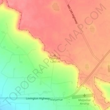
Name: Caprock topographic map, elevation, terrain.
Location: Caprock, Lea County, New Mexico, 88264, United States (32.86703 -103.76323 32.86713 -103.76313)
Average elevation: 4,239 ft
Minimum elevation: 4,088 ft
Maximum elevation: 4,331 ft
Lea County trails, hiking, mountain biking, running and outdoor activities
Thank you for supporting this site ❤️
Make a donation
Make a donation
Gear up for your next adventure:
As an Amazon Associate, this site earns from qualifying purchases at no extra cost to you.