
Thank you for supporting this site ❤️
Make a donation
Make a donation
Gear up for your next adventure:
As an Amazon Associate, this site earns from qualifying purchases at no extra cost to you.
Guggeli topographic map
Click on the map to display elevation.
Thank you for supporting this site ❤️
Make a donation
Make a donation
Gear up for your next adventure:
As an Amazon Associate, this site earns from qualifying purchases at no extra cost to you.
About this map
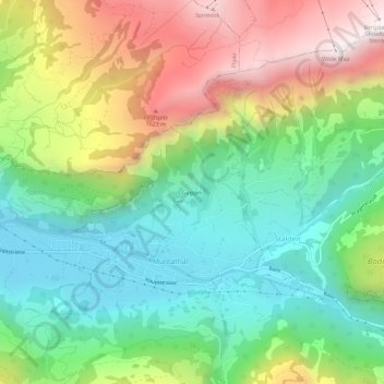
Name: Guggeli topographic map, elevation, terrain.
Location: Guggeli, Stalden, Muotathal, Schwyz, 6436, Suisse (46.96186 8.74915 47.00186 8.78915)
Average elevation: 3,484 ft
Minimum elevation: 1,942 ft
Maximum elevation: 6,004 ft
Thank you for supporting this site ❤️
Make a donation
Make a donation
Gear up for your next adventure:
As an Amazon Associate, this site earns from qualifying purchases at no extra cost to you.