Geolocate

Cacutud topographic map

Click on the map to display elevation.

About this map

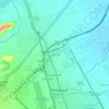
Name: Cacutud topographic map, elevation, terrain.

Location: Cacutud, Mabalacat, Pampanga, Central Luzon, Philippines (15.21811 120.55146 15.25811 120.59146)

Average elevation: 318 ft

Minimum elevation: 246 ft

Maximum elevation: 643 ft

Gear up for your next adventure:

🧤Hiking Gloves - Protective gloves for rugged trails
🕶️GPS Smartphone Mount - Secure mount for phone navigation
🔥Camping Stove - Portable stove for camping and backcountry cooking
🏔️Mountain Trail Maps - High‑detail maps for popular peaks
📷Action Cameras - Rugged cameras to document your journeys across rugged terrain

As an Amazon Associate, this site earns from qualifying purchases at no extra cost to you.