Geolocate

Montemar topographic map

Click on the map to display elevation.

About this map

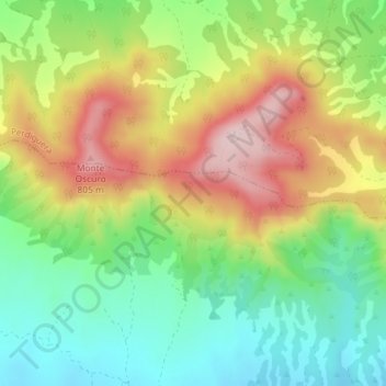
Name: Montemar topographic map, elevation, terrain.

Location: Montemar, Farlete, Los Monegros, Zaragoza, Aragon, Spain (41.71982 -0.55966 41.73982 -0.53966)

Average elevation: 2,146 ft

Minimum elevation: 1,745 ft

Maximum elevation: 2,680 ft

Gear up for your next adventure:

🧣Merino Neck Gaiters - Multi-functional headwear for wind and sun protection
🕶️GPS Smartphone Mount - Secure mount for phone navigation
🪵Folding Camp Saw - Compact saw for wood and campsite work
🔋Solar Power Banks - Keep your GPS and phone charged in remote wilderness areas
🎒Trekking Poles - Sturdy poles for balance and stability on rough terrain

As an Amazon Associate, this site earns from qualifying purchases at no extra cost to you.