
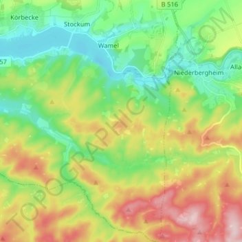
Völlinghausen topographic map
Interactive map
Click on the map to display elevation.
About this map
Name: Völlinghausen topographic map, elevation, terrain.
Average elevation: 971 ft
Minimum elevation: 686 ft
Maximum elevation: 1,444 ft
Other topographic maps
Click on a map to view its topography, its elevation and its terrain.
Stockum
Deutschland > Nordrhein-Westfalen > Kreis Soest > Möhnesee
Stockum, Möhnesee, Kreis Soest, Nordrhein-Westfalen, Deutschland
Average elevation: 892 ft
Südufer
Deutschland > Nordrhein-Westfalen > Kreis Soest > Möhnesee
Südufer, Körbecke, Möhnesee, Kreis Soest, Nordrhein-Westfalen, 59519, Deutschland
Average elevation: 830 ft
Delecke
Deutschland > Nordrhein-Westfalen > Kreis Soest > Möhnesee
Delecke, Möhnesee, Kreis Soest, Nordrhein-Westfalen, Deutschland
Average elevation: 837 ft